


GILA BEND Voting District, Maricopa County, Arizona
About
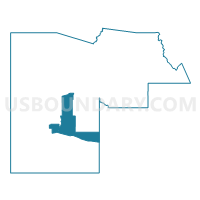
Outline

Summary
| Unique Area Identifier | 524491 |
| Name | GILA BEND Voting District |
| County | Maricopa County |
| State | Arizona |
| Area (square miles) | 412.53 |
| Land Area (square miles) | 412.53 |
| Water Area (square miles) | 0.01 |
| % of Land Area | 100.00 |
| % of Water Area | 0.00 |
| Latitude of the Internal Point | 33.03627940 |
| Longtitude of the Internal Point | -112.59490500 |
Maps


Graphs
Select a template below for downloading or customizing gragh for GILA BEND Voting District, Maricopa County, Arizona


Neighbors
Neighoring Voting District (by Name) Neighboring Voting District on the Map
- ARLINGTON Voting District, Maricopa County, AZ
- BUCKEYE 2 Voting District, Maricopa County, AZ
- BULLARD Voting District, Maricopa County, AZ
- Hidden Valley Voting District, Pinal County, AZ
- LIBERTY Voting District, Maricopa County, AZ
- MOBILE Voting District, Maricopa County, AZ
- PAINTED ROCK Voting District, Maricopa County, AZ
- RAINBOW VALLEY Voting District, Maricopa County, AZ
- SAN LUCY Voting District, Maricopa County, AZ
- SENTINEL Voting District, Maricopa County, AZ
- Tbird Farms Voting District, Pinal County, AZ
Top 10 Neighboring County Subdivision (by Population) Neighboring County Subdivision on the Map
- Buckeye CCD, Maricopa County, AZ (62,196)
- Maricopa-Stanfield CCD, Pinal County, AZ (52,536)
- Gila Bend CCD, Maricopa County, AZ (22,116)
Top 10 Neighboring Place (by Population) Neighboring Place on the Map
Top 10 Neighboring Elementary School District (by Population) Neighboring Elementary School District on the Map
- Buckeye Elementary District, AZ (37,662)
- Liberty Elementary District, AZ (23,944)
- Stanfield Elementary District, AZ (5,193)
- Palo Verde Elementary District, AZ (2,739)
- Arlington Elementary District, AZ (1,472)
- Paloma School District, AZ (301)
- Mobile Elementary District, AZ (124)
Top 10 Neighboring Secondary School District (by Population) Neighboring Secondary School District on the Map
Top 10 Neighboring Unified School District (by Population) Neighboring Unified School District on the Map
Top 10 Neighboring State Legislative District Lower Chamber (by Population) Neighboring State Legislative District Lower Chamber on the Map
- State House District 12, AZ (378,298)
- State House District 4, AZ (294,239)
- State House District 25, AZ (208,220)
Top 10 Neighboring State Legislative District Upper Chamber (by Population) Neighboring State Legislative District Upper Chamber on the Map
- State Senate District 12, AZ (378,298)
- State Senate District 4, AZ (294,239)
- State Senate District 25, AZ (208,220)
Top 10 Neighboring 111th Congressional District (by Population) Neighboring 111th Congressional District on the Map
Top 10 Neighboring Census Tract (by Population) Neighboring Census Tract on the Map
- Census Tract 9414, Pinal County, AZ (8,497)
- Census Tract 506.07, Maricopa County, AZ (6,505)
- Census Tract 7233.06, Maricopa County, AZ (5,259)
- Census Tract 506.03, Maricopa County, AZ (4,536)
- Census Tract 506.11, Maricopa County, AZ (4,477)
- Census Tract 7233.04, Maricopa County, AZ (4,230)
- Census Tract 506.04, Maricopa County, AZ (3,727)
- Census Tract 7233.05, Maricopa County, AZ (2,745)